

This article has interactive before and after images that you can look at.
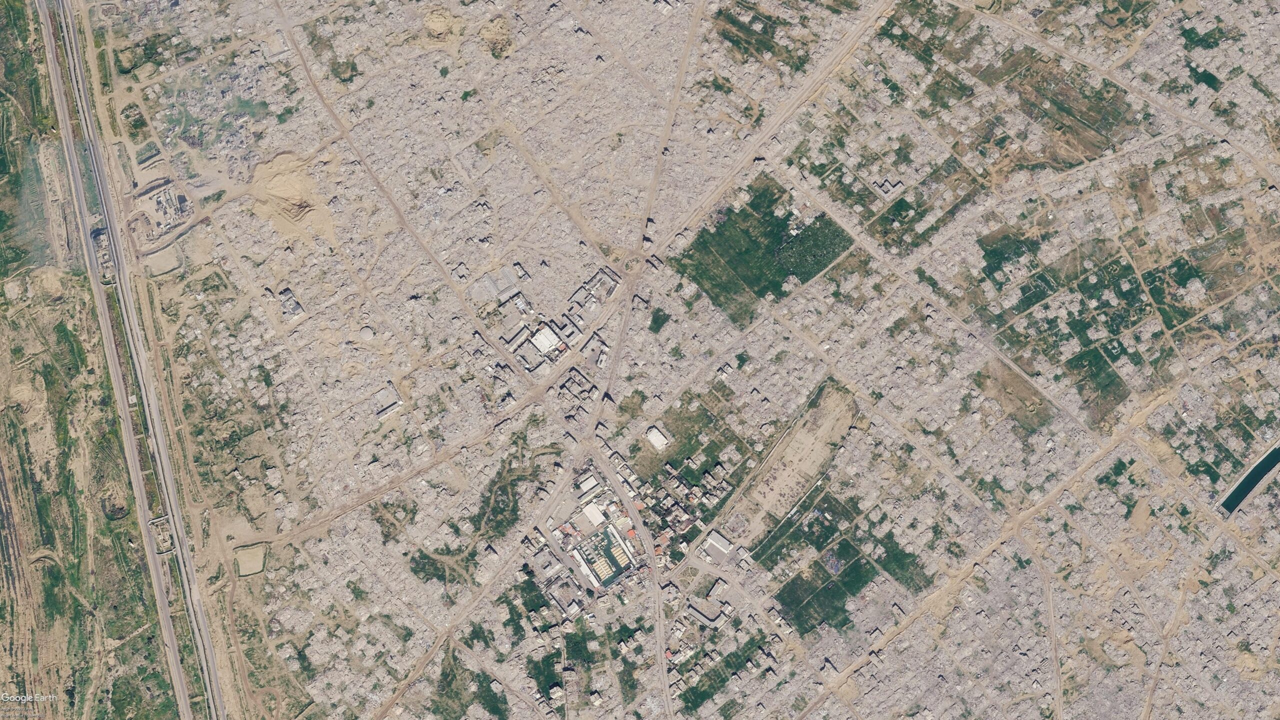
Earlier this week, several viral social media posts and news articles stated that Google had updated satellite imagery over Gaza.
The imagery shared in these posts and articles shows several areas, including the southern city of Rafah. Huge destruction is detailed in the images, including what appears to be entire neighbourhoods flattened
But the imagery wasn’t entirely new.
A Google spokesperson told Bellingcat that they regularly updated third-party satellite images and that the latest Gaza imagery had actually been available since June 2026.
Bellingcat has access to satellite imagery from commercial space company Planet Labs, which shows further destruction in Rafah after the June Google update.
The Planet Labs imagery also gives insight into destruction further north in Gaza as recently as September.
Someone should make this into a VR experience. Maybe then people will actually grasp the reality for the people on the ground.
Sure for the .000001% of people with a VR headset who would care enough to download and try it.
Could make it an installation at a museum or gallery. Who said anything about needing to personally own the hardware?
it could be done without VR, like first person games do