

A Chinese company’s publication of AI-enhanced satellite images of US bases in the Middle East is helping Iranian forces identify targets, US intelligence believes.
The ABC has been briefed on the intelligence by a source inside US defence, who says the images are endangering lives.
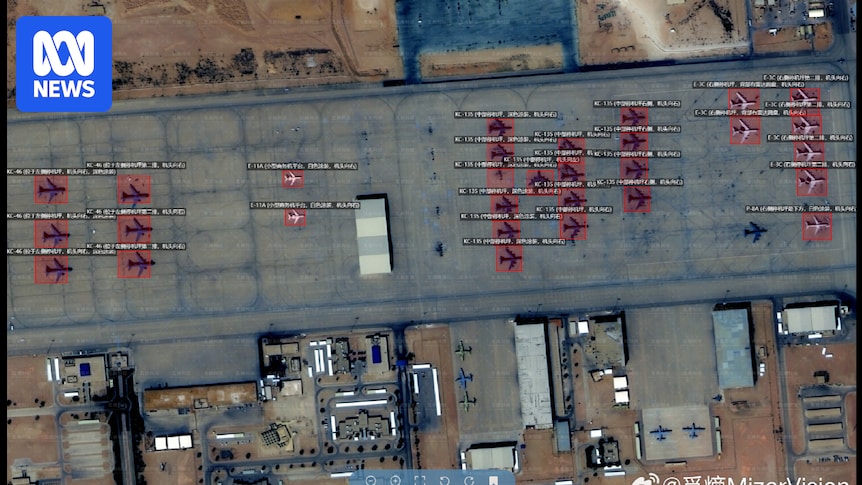
Chinese geospatial artificial intelligence and software company MizarVision, which the Chinese government has a small ownership stake in, has been publishing detailed satellite images with tagging data of multiple US military sites in the lead-up to, and during, the Iran war.
The imagery showcases an AI tool that identifies and tags military forces across vast areas, a capability that once required the resources of a national intelligence agency.
I’d say they’re hemorrhaging hard power too, the US strategy was always to immediately establish air dominance and then win from there, but it turns out that step 1 kinda just doesn’t work against people armed with more than old toyotas and tents. I’d still bet on the US to win if they just wanted to flatten some place but I’ve got serious questions on their ability to achieve a non-phyric victory against any near-peer after this display.