

A Chinese company’s publication of AI-enhanced satellite images of US bases in the Middle East is helping Iranian forces identify targets, US intelligence believes.
The ABC has been briefed on the intelligence by a source inside US defence, who says the images are endangering lives.
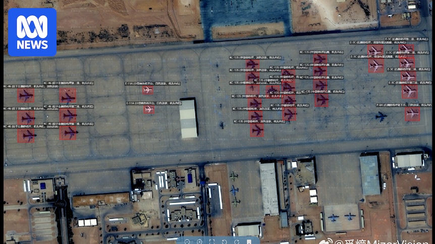
Chinese geospatial artificial intelligence and software company MizarVision, which the Chinese government has a small ownership stake in, has been publishing detailed satellite images with tagging data of multiple US military sites in the lead-up to, and during, the Iran war.
The imagery showcases an AI tool that identifies and tags military forces across vast areas, a capability that once required the resources of a national intelligence agency.
Fitting, considering this war is merely a steppingstone to war with China.
if it is, the USA is completely fucked… no amount of money can overcome this level of ineptitude